
01 / PRIVATE
Your records stay in your systems.
AI receives your question and a description of your systems. The records, files and map data it finds stay outside the AI.
See how privacy worksPrivate records. Repeatable searches. Clear evidence.
Analyze complex maps, permits, and documents in plain English. AI interprets your question; fixed rules search your records. The AI remains completely blind to the underlying data, and each result comes with the proof behind it. Legally defensible outputs and zero data leakage risks.
AI receives your question and a description of your systems. The records, files and map data it finds stay outside the AI.
See how privacy worksAI turns your question into a search. MOSAIC checks it, follows fixed rules and records the steps. Repeat the same search on the same data for the same result.
See how searches workKeep the question, search steps, sources and history together. Show staff, attorneys and reviewers how you reached the answer.
Explore the evidence trail MOSAICPRODUCT TOUR
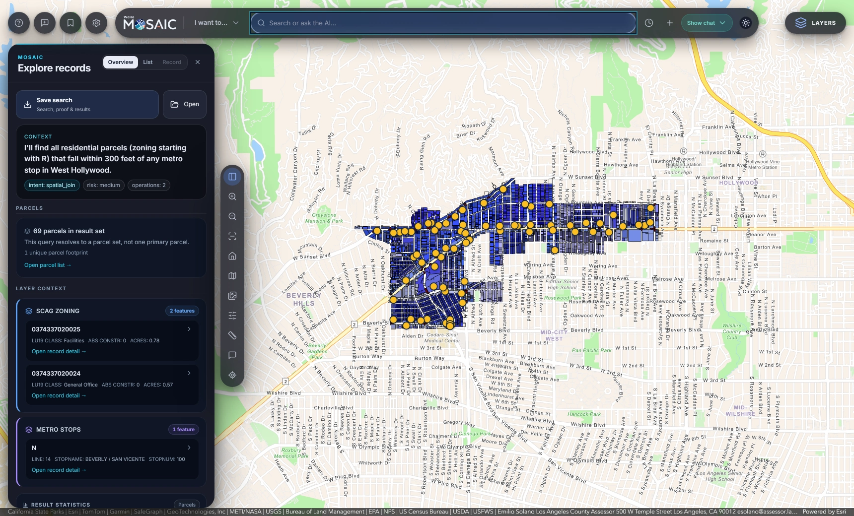
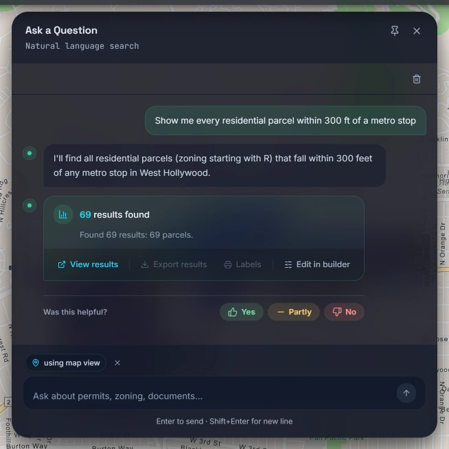
Show me every residential parcel within 300 ft of a metro stop.
Recorded in West Hollywood · Explore the map and records below.
MOSAICPowered by Esri. Esri Community Maps Contributors | California State Parks | Esri | TomTom | Garmin | SafeGraph | GeoTechnologies, Inc | METI/NASA | USGS | Bureau of Land Management | EPA | NPS | US Census Bureau | USDA | USFWS
Explore two recorded sessions from West Hollywood, captured September 8 and 9, 2026. Open the list of 69 parcels, select a result, or save the search. This demo runs in your browser using the recorded results.Take a closer look
The AI interprets your question. MOSAIC then checks and runs the query in your systems, keeping a record of the steps and sources used.
Type an address, an APN, a case number or a full sentence into the same bar.
The model uses your question and catalog descriptions to identify the relevant layers, filters, dates and distances. MOSAIC shows you that interpretation before the search runs.
MOSAIC checks the interpretation against your catalog and access rules, then prepares the query, including any distance calculations and coordinate settings.
MOSAIC runs the query against your connected GIS and permitting data. Your server applies access rules to determine which records and fields each person can see.
MOSAIC records the question, how it was interpreted, the query and its sources. The audit log also records searches that return no results.
What the model receivesYour words, and a static description of your catalog: layer names, fields, value hints.
What stays in your systemsThe records, documents and map features returned by the search.
Your information is spread across systems. Your staff spend their time finding it, connecting it and explaining what it means.
One question.
Three places to start looking.
Find the parcel and check its zoning.
Track down permits and project details.
Find the plans that explain the project.
Then connect the dots. And show how you got there.
 With MOSAIC
The parcel, the permits and the plans. Connected.
Your teams keep the systems they know. MOSAIC brings the search together.
These screenshots show MOSAIC working with West Hollywood’s GIS and permitting data. Scroll through the tour or enlarge an image to explore the details.
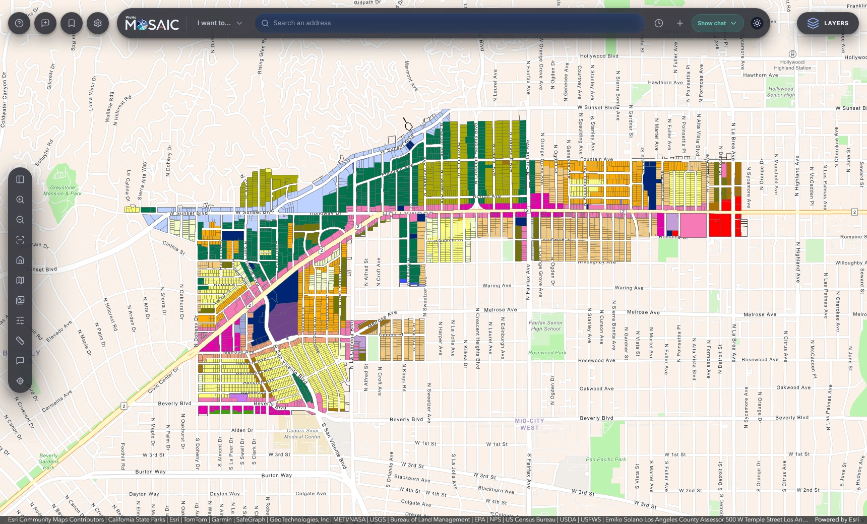
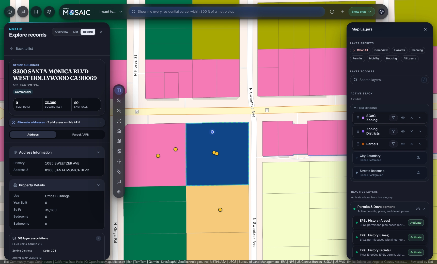
Look up an address, parcel number or permit, or type a question in your own words. The search bar identifies what you entered, while the map tools and layer controls stay within reach.
MOSAIC restates your question and shows the planned search, including its risk level and number of steps. In this recorded example, it found 69 residential parcels within 300 feet of a Metro stop and marked them on the map.
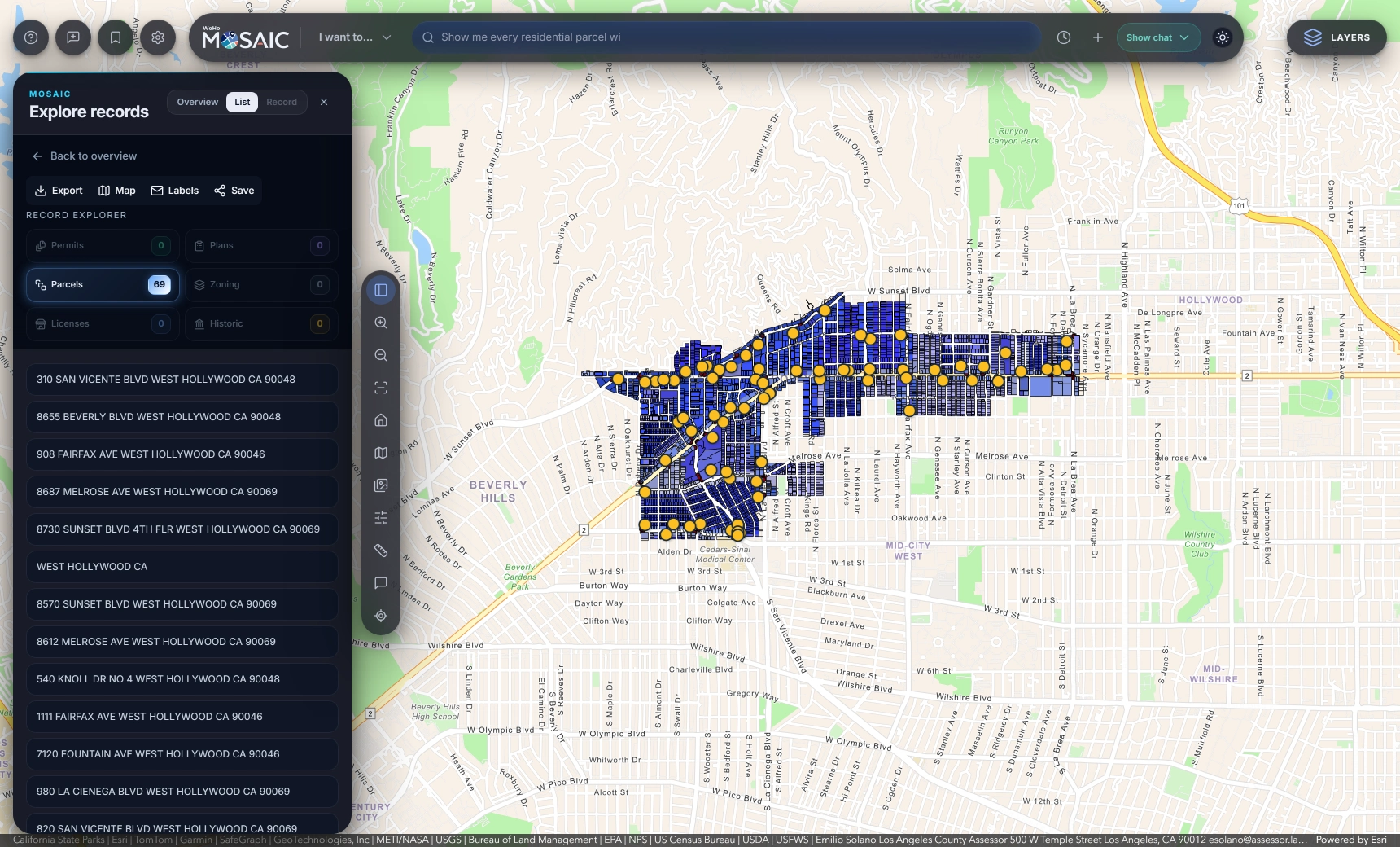
Browse the matching records by type, then open any row to see its details beside the map. From the results, you can export data, create mailing labels or save the search for later.
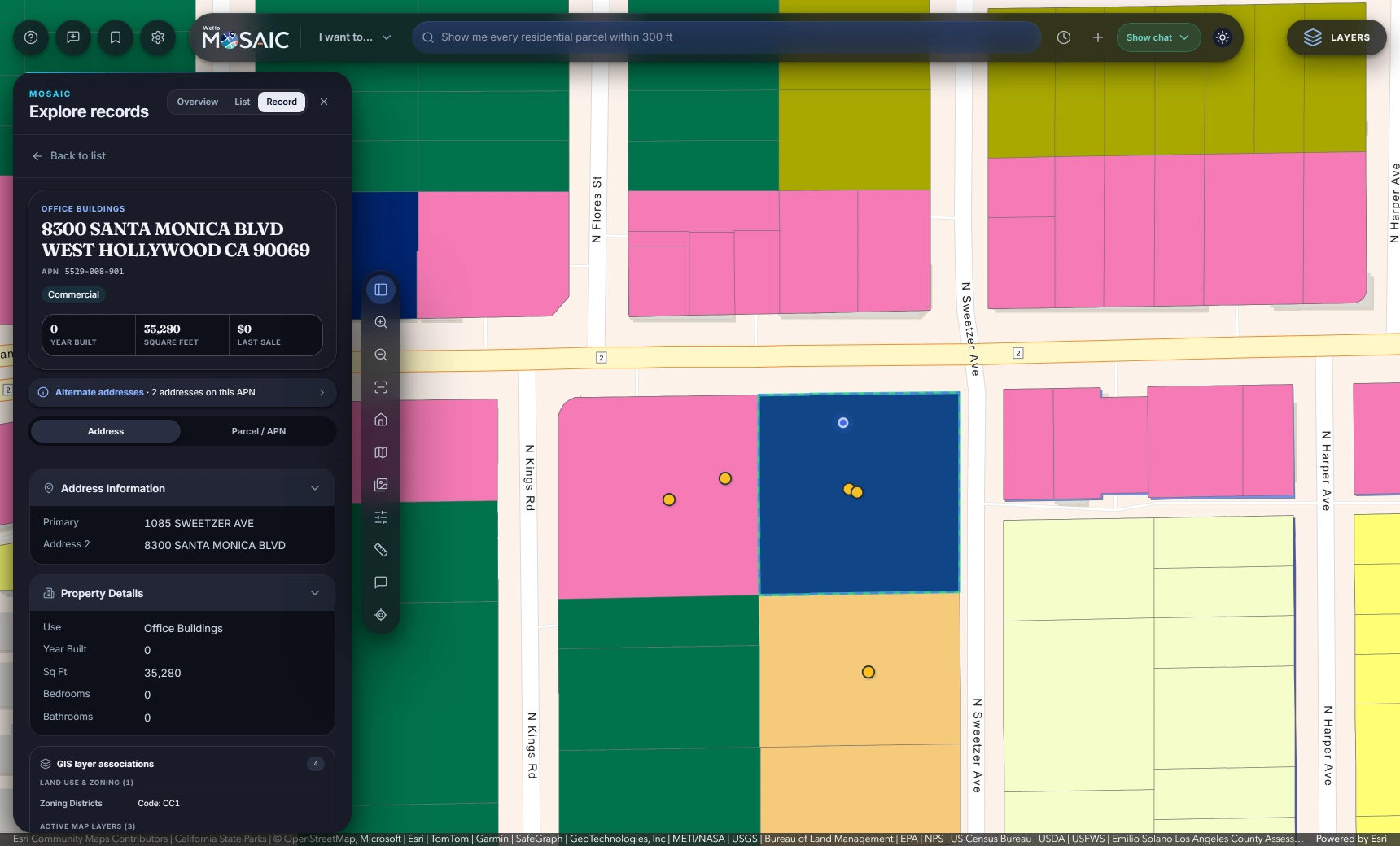
The record for West Hollywood City Hall brings together its address, parcel number, property details, zoning and associated permits. Ownership fields appear only for people with permission to view them.
Choose a preset for planning, permits, housing, mobility or hazards, then adjust the layers to suit the task. You can change their order, filter them and add Tyler EnerGov permit history from the same panel.
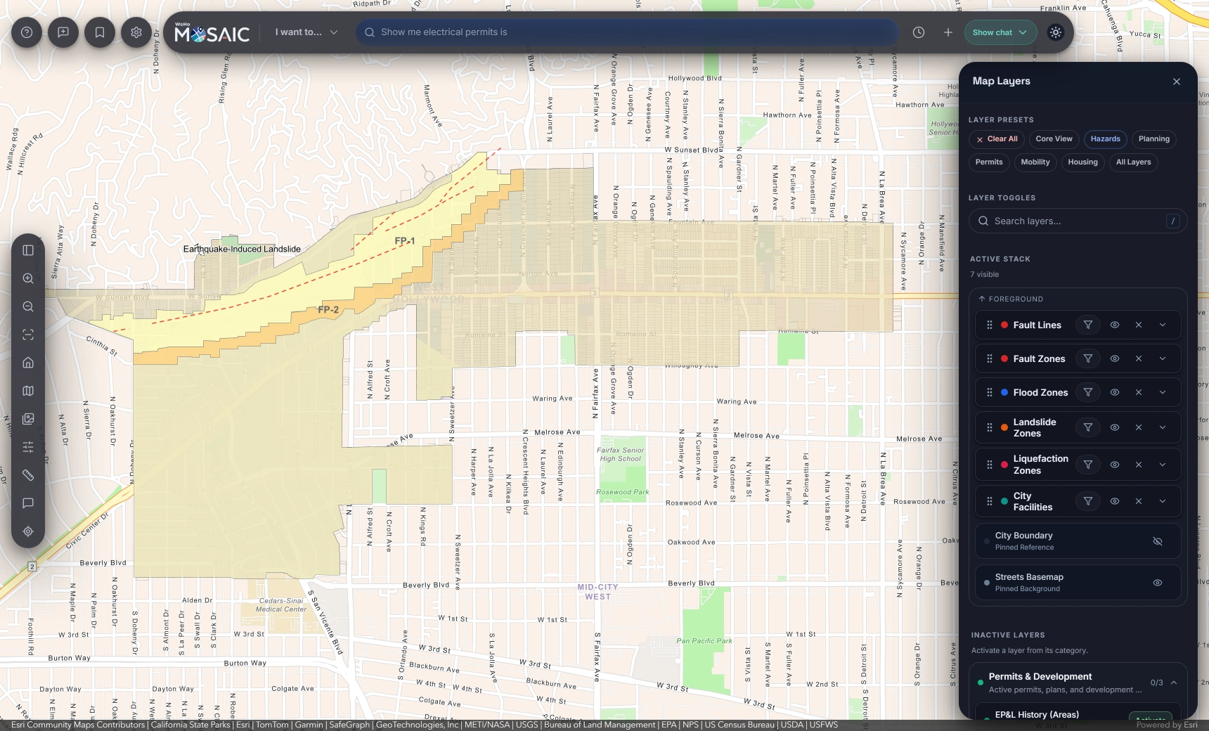
View fault zones, flood areas, landslide zones and liquefaction areas over the parcel map. Searches use the connected hazard layers and record which sources were checked.
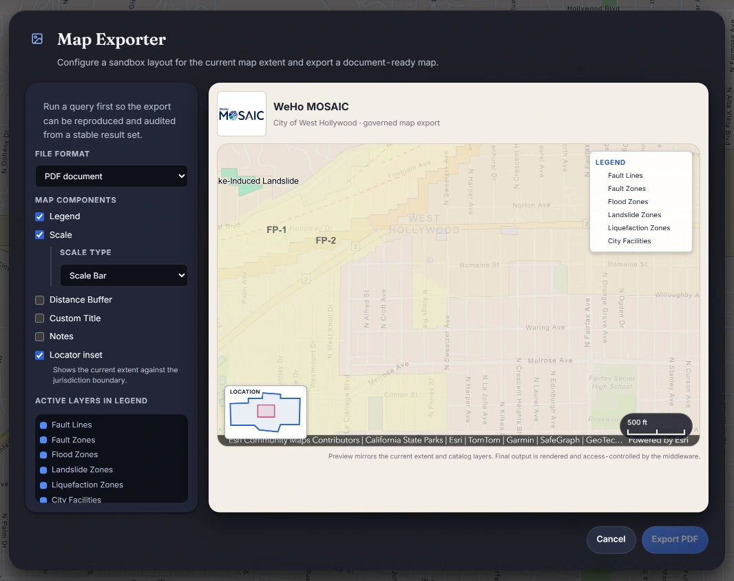
Run a query, then use Map Exporter to prepare a map of the results. Add a legend, scale bar, locator inset and notes for a report or meeting. The server applies your access rules when creating the export.
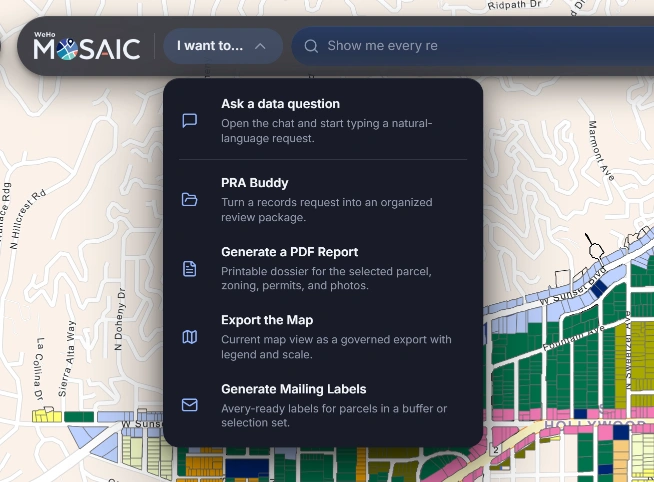
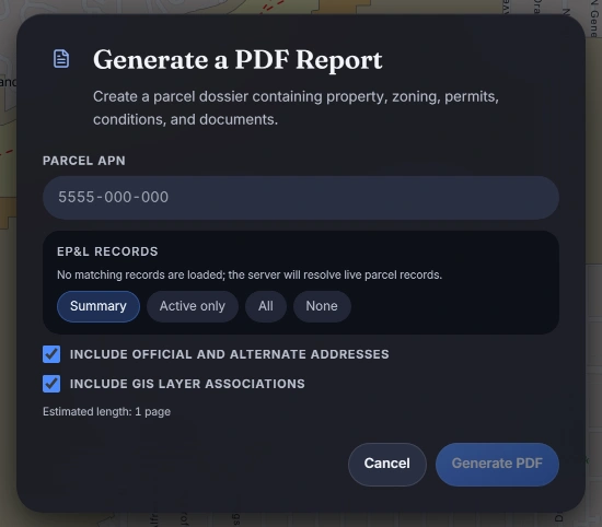
The I want to… menu brings together common tasks: ask a question, collect public records, prepare a parcel report, export a map or create mailing labels. Each uses your existing sign-in and access permissions.
When someone asks how you reached a finding, you need more than a screenshot. Save the question, the query that ran and the available source evidence alongside your results. A colleague or reviewer can then follow the work without starting the search again.
The model receives your question and catalog descriptions to interpret the search. MOSAIC does not send the resulting records or documents back to the model.
MOSAIC saves both the interpretation and the query that ran, so you can compare what you asked with what was searched.
Save the question, search plan and available source details in a file you can open again. Checksums let you check whether the saved content has changed.
The audit log records queries, record views, document access and exports, including searches with no matches.
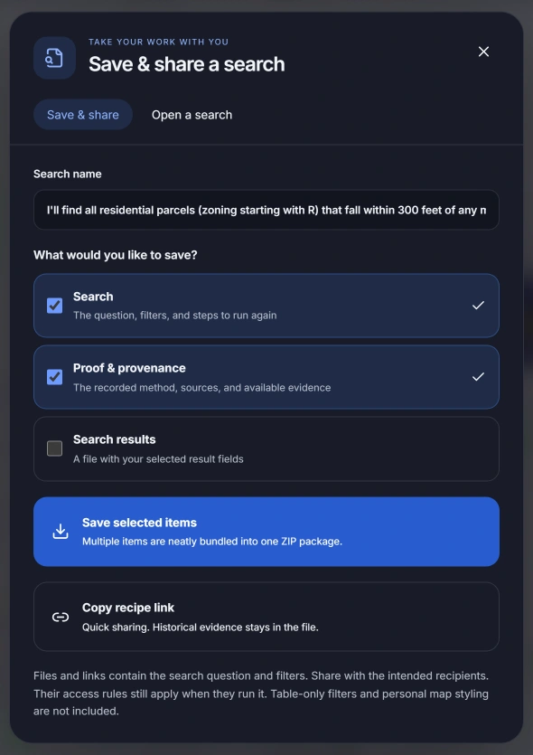
This example includes the search and result checksums recorded on September 9, 2026. Your browser calculates a separate checksum for the download itself.
MOSAIC is designed to support work that needs to stand up to review. The saved search captures the question, method and available source evidence; the audit log records who ran it and when. Together, they help your team explain a finding and check the saved record.
Your team still evaluates the sources and decides how to use the findings. MOSAIC keeps the search history and evidence available for that review.
“What has been approved on this block in the last five years?”
Entitlements and permits on the map, with the zoning context and the documents behind them.
“Which open permits have had no inspection in 180 days?”
A list you can export, map, and send with the query that produced it.
“Every active case within 500 feet of this address.”
Cases, permits and licenses around a location, ready for a site visit.
“All plan files for this address since 2020, with the request attached.”
A PRA Buddy package with a manifest, checksums and a list of what could not be found.
“Show me exactly how this answer was produced.”
The question, the plan, the sources, the timestamps and the hashes, in one file.
“How can staff handle routine searches themselves?”
Configure once in Municipality Studio. Staff answer their own questions under the permissions you set.
Departments share a catalog and sign-in system, with access based on each person’s role. Staff can work from the same parcel record while seeing only the information they are permitted to access.
Find records that meet several conditions, follow a street corridor or compare activity across years. MOSAIC records the method with the results, so your team can review the search or run it again.
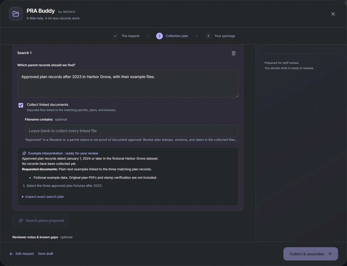
Paste a records request into PRA Buddy and review the proposed searches. Once you approve the scope, it gathers the connected GIS records and permit files into a package, with an index of what was collected and any gaps that need attention.
START-HERE.html            readable index and review notes
request.txt                the original request
manifest.json              coverage, catalog fingerprint, SHA-256 per file
gis/01-parcels/            records.csv · records.geojson · .shp · source.json
records/01/plan.json       the reviewed, executable search
records/01/execution.json  what actually ran, and what failed
records/01/attachment-index.csv  retrieved · excluded · duplicate · failed
records/01/files/…         the original file bytes
Staff review the collected files, follow up on gaps and decide what can be released. Open PRA Buddy here to try the workflow with sample data.
Keep maintaining your data in ArcGIS, Tyler EnerGov and Laserfiche. MOSAIC connects those sources so staff can search across them and keep a record of what they find.
Connect your published layers and geocoding services while continuing to maintain them in ArcGIS.
Permits, plans, licenses, inspections and their files, synchronized and queryable alongside the map.
Documents searched and retrieved on demand for a case or a request. Never bulk-copied.
Staff sign in with the accounts they already have. Roles map from directory groups.
Sensitive fields such as ownership are removed on the server before a response leaves it. Exports are rendered server-side and redacted per role.
Set up connections, choose available layers and verify a customer’s configuration in the browser.
Developed with the City of West Hollywood and running on its live GIS and permitting data. Run on your servers, in your cloud, or hosted. Product imagery shows MOSAIC in West Hollywood and does not imply City or vendor endorsement.
Select your community’s population to see the starting annual price for each plan. All three include access for staff across your city.
See what that could mean for your teamYour selection updates the starting price for all three plans.
Compare what’s included below. Select your population above to reveal prices.
Search your maps and records together.
Priced by population
Collect records and files for staff review.
Priced by population
Bring research, records requests and assisted permit review together.
Priced by population
The paper trail is included in every plan. Save the question, the search plan and available source evidence with the work you export.
A clear quote before you commit. Planning prices in USD, billed annually. Implementation is quoted separately. Hosting, third-party services, applicable taxes and custom integrations are additional. Your quote specifies processing and storage allowances, support, and any additional capacity. No automatic overage charges.
Population sets the starting band; the final quote reflects scope and workload. We propose holding your population band for a three-year agreement, with the annual fee schedule agreed up front. Permit review coverage and availability are confirmed in a pilot.
Smaller community or private-sector team? Ask about a focused rollout or pricing for your firm’s portfolio. Talk through your options
Enter the number of reviews or requests your team handles each month. These examples show how a shorter process could affect annual staff hours and their value.
Illustrative planning scenarios, not measured MOSAIC results or guaranteed savings.
Spend less of each review gathering context and checking supported requirements. Give reviewers more time for the decisions that need their judgment.
Example assumes 2.8 hours recovered per review at $85/hour, including salary and benefits.
Gather connected records and files into a review package. Count requests involving GIS, permits, plans or other records available to MOSAIC.
Example assumes 2.4 hours recovered per request at $70/hour, including salary and benefits.
Monthly count × 12 × hours recovered per item = annual hours. Annual hours × the stated staff rate = staff-time value. These are editable workload examples with fixed time and rate assumptions, not forecasts of your team’s results.
Permit reviews use 4 hours before and 1.2 hours with assistance (30% of the original time); relevant PRA requests use 3 hours before and 0.6 hours with assistance (20% of the original time). Both scenarios retain staff review. Request complexity, source coverage, document quality and adopted codes affect the outcome. PRA estimates exclude work involving sources MOSAIC cannot access.
Staff-time value is capacity your team could use elsewhere. It is not a budget reduction, net savings or a payback calculation; subscription, implementation and operating costs have not been deducted. The two estimates are separate and should not be added if they cover the same work. During a pilot, we can compare completed work against your own baseline.
Find parcels, zoning and permits together. Give staff a way to answer routine questions using the maps and records your city already maintains.
Explore the workflow →Turn a request into a collection plan. Gather connected records and files, with an index of what was found and what still needs attention.
Explore the workflow →Connect the systems you already run. Bring maps, permits and documents together with existing sign-in and server-enforced access rules.
Explore the workflow →Bring a records request, a site question or a search your team handles often. In a thirty-minute demo, we’ll walk through the search, open the results and show you what can be saved and shared.
sales@mosaicinfo.tech