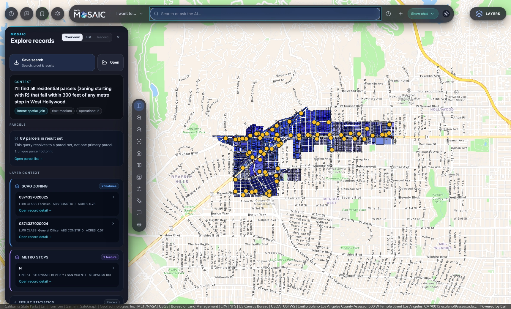
One question. The relevant maps and records.
A resident calls about construction next door. Planning needs the zoning and entitlements. Building staff need the permit history. The plans may be in a separate document archive. MOSAIC gives those searches a shared starting point: an address, parcel number, case number or question in plain English.
Results stay connected to their locations and source records. Open a parcel to see its property details, zoning and associated permits, then follow the linked documents available to your role. Your departments continue maintaining their data in the systems they already use.
Give staff a search bar. Give GIS teams control.
MOSAIC interprets a question using descriptions of your catalog, then shows the planned search. It checks the interpretation against the available layers and access rules before running the query. Staff can see what will be searched instead of treating an answer as a black box.
GIS and IT teams configure connections and available layers in Municipality Studio. Microsoft Entra ID supports existing staff sign-in, with roles mapped from directory groups. Access rules are applied on the server, including restrictions on sensitive fields.
Ask questions that cross layers, locations and time.
Find permits on historic properties within a fault zone. Identify residential parcels near transit. Compare business license renewals across two years. MOSAIC supports searches that connect published layers with permitting records, including distance calculations and spatial relationships.
The saved search records the method, sources and query alongside the results. Teams can review how a finding was produced, share the available evidence and export a map or result set for the next stage of their work.